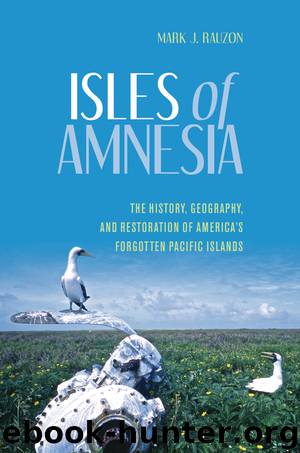
Isles of Amnesia by Mark J. Rauzon

Author:Mark J. Rauzon
Language: eng
Format: epub
ISBN: 9780824857523
Publisher: University of Hawaii Press
6
JOHNSTON ATOLL
AS THE GOOD SHIP SS MIDWAY approached Johnston Atoll, I could see a large refinery with three tall smokestacks venting the exhaust of chemical weapons that were being incinerated in the deescalation of the Cold War and as a safety measure for aging weaponry. The military command radioed the ship to inform us that we had to shave off our beards. No worries for my meager stubble but the hirsute among us were mad. Why? Because the government-issued gas masks we would be given upon landing at Johnston would not work over facial hair. And if a nerve gas leak occurred while we were there—if we heard blaring sirens coming from the incineration plant—we were to don the masks, inject our thigh with a dose of atropine, and pray for the best outcome.
To reach Johnston, one of the most isolated atolls in the world, we had traveled across the Doldrums of the Central Pacific, traveling north some twelve hundred miles from Howland Island. Crossing the equatorial currents, we entered the Hawaiian bioregion from the southern Phoenix Islands bioregion, a demarcation that would have significance with Cold War weapons testing. After a miserable week of cruising, we eagerly docked at Johnston to catch a flight back to Honolulu. Thank goodness I didn’t have to stay long, for the place gave me the creeps.
More people have been to Johnston Atoll than to any other island in the Pacific Marine Monuments, and know it as J.A. Continental Airlines flew the island-hopper from Honolulu to Guam and back, stopping at Pohnpei, Kwajalein, and Johnston. But unlike at other stops, marines with machine guns stood at the bottom of the Jetway. J.A. was far enough away for classified government work, but a relatively short trip by ship or air. An outlier of the Line Islands and about 718 nautical miles southwest of Hawai‘i, with annual rainfall of less than twenty inches, it is a dry atoll, unlike Palmyra, so materiel doesn’t decompose as quickly. All that was needed was air conditioning.
First discovered by the American brig Sally in 1796, it was later named after the British captain Charles Johnston of the Cornwallis on December 14, 1807. Fifty years on, the American schooner Palestine claimed the island for the United States, but within three months, the Hawaiian schooner Kalama removed Old Glory and flew the Hawaiian flag, only to be followed again by the Palestine restoring the Stars and Stripes. King Kamehameha IV declared Johnston “derelict and abandoned” and annexed it to the Kingdom of Hawai‘i, naming it Kalama. Yet when Hawai‘i was made a US territory, Johnston was not included in the list of Hawaiian Islands.1 But that did not stop the Territory of Hawai‘i from leasing it for guano digging and considering a cable station placed there.
In 1923, the minesweepers USS Whippoorwill and USS Tanager carried members of the Tanager Expedition. Onboard was the aviator, Commander John Rodgers, famous for his seaplane flight from California to Hawai‘i. On the inaugural seaplane flight over
Download
This site does not store any files on its server. We only index and link to content provided by other sites. Please contact the content providers to delete copyright contents if any and email us, we'll remove relevant links or contents immediately.
The Lonely City by Olivia Laing(4798)
Animal Frequency by Melissa Alvarez(4461)
All Creatures Great and Small by James Herriot(4311)
Walking by Henry David Thoreau(3953)
Exit West by Mohsin Hamid(3823)
Origin Story: A Big History of Everything by David Christian(3687)
COSMOS by Carl Sagan(3617)
How to Read Water: Clues and Patterns from Puddles to the Sea (Natural Navigation) by Tristan Gooley(3460)
Hedgerow by John Wright(3354)
How to Read Nature by Tristan Gooley(3335)
The Inner Life of Animals by Peter Wohlleben(3309)
How to Do Nothing by Jenny Odell(3293)
Project Animal Farm: An Accidental Journey into the Secret World of Farming and the Truth About Our Food by Sonia Faruqi(3212)
Origin Story by David Christian(3194)
Water by Ian Miller(3177)
A Forest Journey by John Perlin(3067)
The Plant Messiah by Carlos Magdalena(2927)
A Wilder Time by William E. Glassley(2858)
Forests: A Very Short Introduction by Jaboury Ghazoul(2836)
